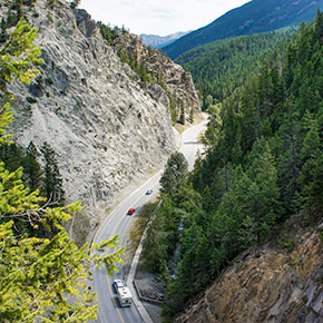
Driving to Toby Creek Adventures from Banff or Canmore, AB, is an incredible and scenic adventure through Kootenay and Banff National Park
Take your time and enjoy these beautiful points of interest along Highway 93 South in Kootenay National Park.
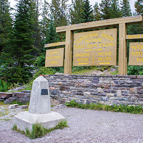
Visit the Continental Divide
Location: 94 km east of Radium B.C. on Hwy 93 South(map)
Stand on the Continental Divide – the point from which water flows to two different oceans. Stand in two provinces at once. This is the continental spine of western North America. This location separates two watersheds, two provinces, and two national parks.
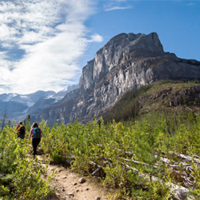
Hike Stanley Glacier
Location: 95 km east of Radium B.C. on Hwy 93 South (map)
Feeling energetic? Hike the amazing trail of fire and ice to Stanley Glacier. Beginning in an expansive fire-swept forest with lodgepole pines and a profusion of wildflowers, this 10 km return (6.3 miles) hike crosses a turquoise river, passes by waterfalls and gives close-up views of the Stanley Glacier. Hidden at the base of Mount Stanley are trilobites, hyolithids, brachiopods, sponges and algae.
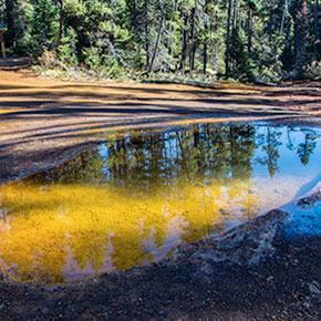
Explore the Paint Pots
Location: 84 km east of Radium B.C. on Hwy 93 South(map)
Stroll along a 2km trail to the Paint Pots, an indigenous cultural site. Snap a photo of the three iron-rich mineral springs that stain the earth red. This unusual orange ochre bed is important to many Aboriginal peoples who gathered the ochre for centuries for use in ceremonies and trade. In the early 1900s ochre was mined and shipped to Calgary, where it was used as a pigment in paint. Remnants of twentieth-century mining are still visible along the trail.
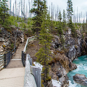
Trek Marble Canyon
Location: 87 km east of Radium B.C. on Hwy 93 South (map)
Turquoise, glacial waters and startling canyon walls grow more impressive along this short trail. Multiple bridges span the narrow gorge, crossing several times for spine-tingling views of the river below. Watch for fuchsia fireweed and mountain bluebirds in a landscape shaped by fire, erosion, and mountain-building.
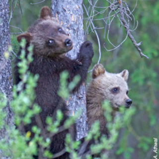
Spot the wildlife
Location: Throughout the drive
Deer, bears, goats, wolves and bighorn sheep all call the Kootenay National Park home. Keep your binoculars ready and learn how Parks Canada is helping wildlife cross the highway safely at Dolly Varden day-use area. A friendly reminder: Please do not stop or exit your vehicle while wildlife is nearby.
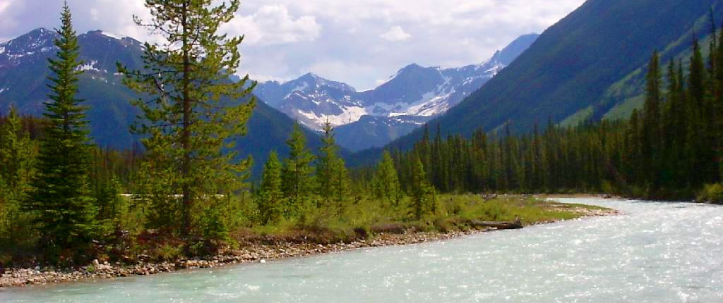
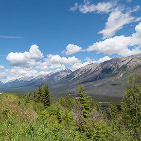
Marvel at Kootenay Valley Viewpoint
Location: 16 km east of Radium B.C. on Hwy 93 South (map)
Admire breathtaking views of the Mitchell and Vermillion ranges from the Kootenay Valley Viewpoint. This roadside viewpoint provides breathtaking views of the Mitchell and Vermilion mountain ranges and the Kootenay River far below. Watch the river wind through the rich, montane forest following an ancient route to Castlegar, B.C. where it unites with the great Columbia River.
Look up at the towering red cliffs of the Redwall Fault in Sinclair Canyon. One of the most impressive gateways to a national park in Canada, offering views of Sinclair Canyon below and the Redwall Fault cliffs above. Trails on both sides of the highway can be accessed at the north and south ends, from the Redstreak area to the east, and Juniper Trail to the west.
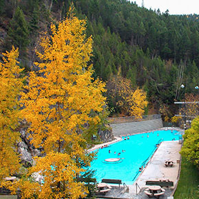
Relax in the Radium Hot Springs
Location: 3 km east of Radium B.C. on Hwy 93 South.(map)
One of our favourites! Relax in the Radium Hot Springs pools before or after your ATV or Snowmobile trip – a perfect way to complement your trip. Soak in the naturally-heated, mineral-rich hot pool between the sheltering walls of Sinclair Canyon. Radium is one of three thermal swimming pools in the Rocky Mountain National Parks – luxurious in summer and magical in the winter.
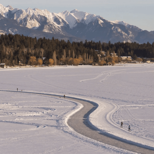
Explore the Whiteway
Location: 2 km south of downtown Invermere BC
Experience The Whiteway – The World’s longest ice-skating trail – Guinness Book of World Records – skate, ski, walk.
This website uses cookies to improve your experience. We'll assume you're ok with this, but you can opt-out if you wish. Cookie settingsACCEPT
Privacy & Cookies Policy
Privacy Overview
This website uses cookies to improve your experience while you navigate through the website. Out of these cookies, the cookies that are categorized as necessary are stored on your browser as they are essential for the working of basic functionalities of the website. We also use third-party cookies that help us analyze and understand how you use this website. These cookies will be stored in your browser only with your consent. You also have the option to opt-out of these cookies. But opting out of some of these cookies may have an effect on your browsing experience.
Necessary cookies are absolutely essential for the website to function properly. This category only includes cookies that ensures basic functionalities and security features of the website. These cookies do not store any personal information.
Any cookies that may not be particularly necessary for the website to function and is used specifically to collect user personal data via analytics, ads, other embedded contents are termed as non-necessary cookies. It is mandatory to procure user consent prior to running these cookies on your website.